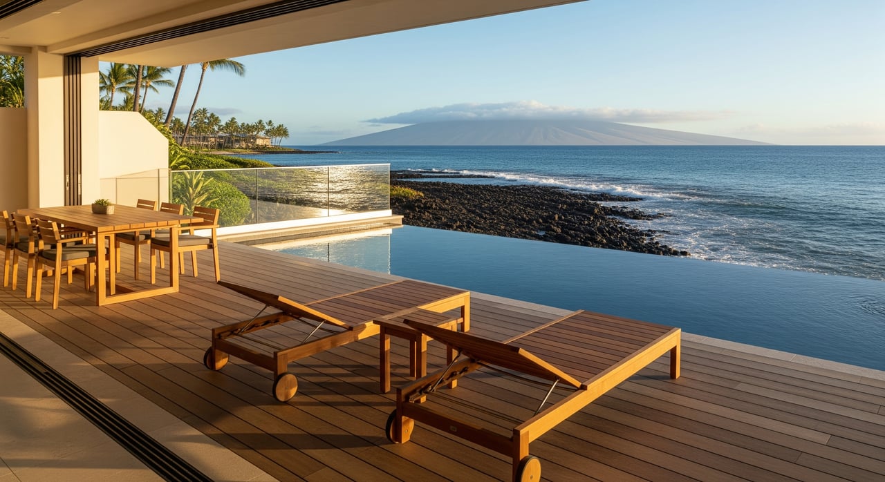
You are buying or selling oceanfront in Lahaina, and you want to know how sea level rise could change what a property is worth. That is a smart question. On Maui’s west side, shoreline rules, erosion, and insurance trends all shape value, not just views and square footage.
In this guide, you will learn how Hawaiʻi’s Sea Level Rise Exposure Area maps and Maui County shoreline rules work together, what they do and do not tell you, and how exposure can affect pricing, lending, and insurability. You will also get a clear checklist you can use before you make an offer or set a list price. Let’s dive in.
What SLR maps show in Lahaina
Hawaiʻi’s Sea Level Rise Viewer includes Sea Level Rise Exposure Areas. These map layers highlight where land could be exposed under different sea level scenarios. They are consistent visual tools that help you screen parcels and flag the need for deeper study.
These maps are scenario based. They show where water would reach at a certain water level, not when it will reach that level. They commonly model passive inundation and related exposure, which does not fully capture local wave runup, storm surge, or bluff retreat. Treat them as a first pass, not a final decision.
The maps are not automatically regulatory. Counties must adopt rules and setbacks before those lines become permit controls. In Lahaina, you will use the exposure layers to ask better questions, then confirm how Maui County measures your setback from the certified shoreline.
Maui shoreline rules and permits
Certified shoreline and setback
Your regulatory baseline is the certified shoreline, which is established through a formal survey process. Maui County measures shoreline setbacks from that certified line. Depending on the parcel and method in use, setbacks can reflect fixed distances or erosion hazard calculations that protect landward buffers.
A narrow oceanfront lot can see a reduced buildable area once you plot the certified shoreline and apply county setback rules. That can push structures landward or limit new construction. It also influences what a buyer can plan for over a typical 30 to 50 year horizon.
SMA and coastal hazard review
Many oceanfront projects fall inside the Special Management Area. If your plans touch a setback area or raise coastal hazards, the county may require a coastal hazards assessment, engineered mitigation, and additional permits. Some forms of shoreline hardening are restricted or discouraged and can be difficult to permit.
Exposure on a map does not mean a ban on building. It often triggers more scrutiny, design changes, and mitigation requirements. The practical outcome is usually about siting, elevation, and long-term resilience, not an automatic no.
Erosion versus inundation
Flooding relates to water covering land. Erosion is land loss over time from waves and shoreline migration. In Maui, erosion often governs setback distance and long-term footprint. Meanwhile, FEMA flood maps guide flood insurance and some lender requirements. Both matter, but they serve different decisions.
How exposure affects Lahaina valuations
Buildable area and highest use
When setbacks move landward or a lot narrows, the highest-and-best use can change. A home that fit comfortably on a site in the past may require a more compact footprint or a different orientation today. For existing structures, exposure can limit future additions or even replacement after major damage. That constraint tends to lower what buyers will pay.
Insurance and lending signals
FEMA Flood Insurance Rate Maps determine mandatory flood insurance for federally backed loans in mapped floodplains. Those maps do not directly include long-term sea level rise or shoreline erosion unless updated. Private flood insurers can use their own risk models and may raise premiums or restrict new policies in higher exposure zones.
Lenders review FEMA maps and are increasingly aware of long-term hazard and regulatory risk. If insurability becomes difficult or long-term permitability is uncertain, loan terms can tighten. Higher premiums, exclusions, or reduced policy availability can reduce buyer demand, which affects price.
Market perception and price
Markets tend to respond to clear signals. Public awareness, visible shoreline change, or adopted hazard lines can accelerate price adjustments. Properties that face probable siting restrictions, limited rebuild paths, or higher operating costs often trade with a discount. The more transparent you can be about setbacks, insurance quotes, and hazard assessments, the easier it is to defend your price.
A step-by-step checklist for Lahaina due diligence
- Confirm the legal baseline
- Obtain the deed and title report, plus the most recent certified shoreline survey. Note recorded setbacks and any easements.
- Screen mapped exposure
- Review the Sea Level Rise Exposure Areas and Maui County planning maps for multiple scenarios. Compare with FEMA flood maps for floodplain status.
- Verify local rules for the parcel
- Speak with Maui County Planning to confirm how setbacks are measured for your property and whether any rule updates or policy changes are pending.
- Commission technical reports if needed
- If exposure is indicated, hire a licensed coastal engineer or coastal geologist for a site-specific hazards assessment. Engage a licensed surveyor for a current certified shoreline if the existing survey is not recent.
- Price insurance and confirm availability
- Get written quotes from local brokers for NFIP and private flood, plus homeowners and wind coverage. Ask about exclusions, deductibles, and how premiums could change.
- Consider marketability and timing
- Align your plans with likely buyer profiles and time horizons. Investor expectations for yield and owner-occupant expectations for comfort and maintenance differ.
- Use findings in pricing and terms
- Sellers can price for a smaller buildable area or higher operating costs. Buyers can request disclosures, inspections, and contingency language that address coastal hazard findings.
What this means for Lahaina buyers
If you are considering an oceanfront home or condo in Lahaina, start with your time horizon. For a 10 to 30 year hold, you should focus on current setbacks, near-term erosion signals, and insurance cost stability. For a longer hold, it is wise to test siting and access under scenarios that look 50 to 100 years out.
Be ready to pivot on design. Elevated foundations, thoughtful placement, and resilient materials can help meet permit requirements and protect value. Confirm that any desired renovations or additions are feasible inside the setback. A property that suits your lifestyle now and can adapt to future rules is usually the better long-term value.
What this means for Lahaina sellers
Buyers are asking sharper questions. If you bring clarity up front, you maintain trust and momentum. Gather recent shoreline and setback documentation, provide hazard and insurance context, and be explicit about what the property can support. If a home was built under older rules, show how it complies today and where future changes may apply.
Pricing should reflect the reality on the ground. If setbacks compress buildable area or if insurance is costly, acknowledge it and price accordingly. In a competitive segment, transparency and realistic positioning often shorten time on market and reduce late-stage renegotiations.
Using maps the right way
Use the Sea Level Rise Exposure maps as a screening tool. They help you spot parcels that deserve deeper review. Then shift to parcel-level work: certified shoreline, county rules, and site-specific hazard analyses. This two-step process keeps you from overreacting to a map while also avoiding surprises during permitting.
Remember that local coastal dynamics matter. Reef profiles, sediment movement, and nearby shoreline armoring can change outcomes at a parcel scale. That is why a licensed coastal engineer and a current certified shoreline survey are so valuable for final decisions.
Where to get help on Maui
- Maui County Planning Department for current shoreline setback and SMA guidance
- DLNR Office of Conservation and Coastal Lands for shoreline definitions and certified shoreline procedures
- University of Hawaiʻi Sea Grant for educational materials and SLR viewer guidance
- Licensed coastal engineer or coastal geologist for site-specific hazard analysis
- Licensed land surveyor for a certified shoreline survey
- Local real estate attorney experienced in coastal land law and disclosures
- Local insurance brokers who understand Hawaiʻi coastal coverage
If you would like concierge help applying this framework to a specific Lahaina property, reach out for a tailored walk-through, insurance introductions, and a clean action plan. Get an Instant Home Valuation or Start Your Maui Search with a trusted, local advisor.
FAQs
If a Lahaina parcel sits on a Sea Level Rise Exposure Area, can I still build?
- Not automatically prohibited; it usually triggers added review, setback compliance, and possible mitigation, with final decisions based on certified shoreline, county permits, and technical analyses.
Do FEMA flood maps include long-term sea level rise for Lahaina oceanfront?
- FEMA maps guide NFIP flood insurance and do not directly include long-term erosion or sea level rise unless updated, while private insurers may apply their own forward-looking models.
How far ahead should a Lahaina buyer plan for sea level rise?
- Consider both near-term 10 to 30 year impacts and longer 50 to 100 year scenarios, aligning with your ownership horizon and likely resale timeline.
Will a seawall guarantee protection for my Lahaina property?
- Not guaranteed; shoreline hardening is regulated, may be difficult to permit, can shift erosion to neighbors, and may only delay rather than eliminate local erosion risk.
How does exposure change my property’s appraised value in Lahaina?
- Reduced buildable area, higher insurance costs, and regulatory limits can lower highest-and-best use and buyer demand, which appraisers and lenders increasingly factor into value and terms.